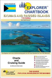
Home Catalog Brands Gift Ideas Bargain Bin Contact Us Partner Site

exumas.jpg Explorer Chartbook: Exumas and Ragged Islands

Explorer Chartbook: Exumas and Ragged Islands


$49.95
(EX) Exumas
Qty   
Bookmark This Page Tell A Friend Rate This Product
Explorer Chartbook: Exumas and the Ragged Islands
5th ED.

NOW WATERPROOF!
by Monty & Sara Lewis
 
Free updates
   Near Bahamas
   Exumas
   Far Bahamas

The Exumas cruising packet of choice! Don't cruise the Exuma Cays without this accurate, up-to-date set of charts - far more detailed than government charts or other sketch charts. The true Explorer is always dreaming about new islands on the horizon. In that light our fourth edition of the Exumas and the Ragged Islands Chartbook presents the additional chart coverage of the Sout'side (Exuma backside).

We have also given a complete facelift to all of our original Exuma charts--now bringing them to you in full-color. You'll notice border scales, new and corrected data, depth contours, updated variation, chart page overlaps and notes on "Joins page..."
 

Explorer Chartbooks: Exumas, including the Ragged Islands Includes
  • 64 up-to-date beautiful full-color charts
  • Tide Tables through 2009
  • Large and small-scale charts and close-ups for confident cockpit navigation
  • GPS waypoints
  • Long-range Tide Tables
  • Extensive soundings
  • Harbor Close-ups
  • Topographical features
  • One-minute grid
  • WGS 84 datum
  • Updated compass roses
  • Notations for adjoining chart pages
  • "Need-to-Know Info" on services and facilities for each settlement and harbor - where to find groceries, fuel, water, marine services, shops, lodging, Customs, laundry services, fax and e-mail, etc.
  • Easy-to-find format
  • The right size for your nav station
  • Spiral binding for easy use
Special Articles Including:
"The Explorer Chartbooks set a new standard for island cruising guides which all must now follow or fall" declares Bruce Van Sant, author of PASSAGES SOUTH.
Please click photo for enlarged view
Detail illustration from Explorer Chartbook "Far Bahamas "
In the sixth year of charting accuracy and excellence, the Explorer Series offers three complete cruising guides (each, two books in one) which cover the Bahamas with all the detail you need for cruising adventure.
These "cruiser-friendly" charts/guides are filled with key waypoints, routes and soundings from on-site surveys and offer in-depth "Need-to-Know Info" for settlements and anchorages.
As one cruiser puts it, "In the Bahamas, if you don't have these charts you don't have ANY charts!"


[Home] [Products] [Gift Ideas] [Bargain Bin] [Your Shopping Cart] [Order Status] [Contact Us]